Alert
Alerts
Rivages


IGN cards


Description
A hike along the coastal path and it's beaches : Débarquement, Héraclée, Sylvabelle and the Vergeron. Idyllic settings, vineyards, architectural heritage.
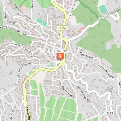
At the Croix traffic circle, opposite the Tourist Office, take the underpass down Boulevard Tabarin, direction “Tabarin, Vergeron, Gigaro”. Turn right on Rue de l'Eglise, then take the next right. At the crossroads, take the footpath opposite on the right, signposted “Les Plages”. Follow the vines on your left. At the “patte d'oie”, take the “voie verte” on your left. After the vineyards, you can take the “Parcours de Santé” (fitness trail) and the “Sentier Botanique” (botanical trail) on your right, or continue straight ahead (the two paths merge). Cross the stream on your left, then take the path on the right between the vines. Cross the other stream and take the track in front of you. At the end of the track, cross the road and turn right. At the traffic circle, turn left to reach the D-Day beach.
Follow the yellow markings and “Sentier du Littoral” signs. Take the stairs on the left at the end of the beach. Pass the Bouillabaisse, Vergeron and Sylvabelle beaches. At Plage d'Héraclée, take Impasse d'Héraclée. Follow the blue markings. At the end of the impasse, turn left onto Boulevard du Littoral. Follow the Croisien vineyard. Follow the pedestrian lane. At the Sylvabelle traffic circle, continue straight ahead. At the next junction, turn right onto Boulevard Tabarin. Follow the pedestrian lane. Turn right onto Rue des Tennis de Tabarin. Then turn left onto Boulevard des Villas. Continue straight on until you reach the tourism office.
Technical Information
Altimetric profile
Starting point
Points of interest


Data author
