Tours
Activities
Places of interest
Where to eat
Where to sleep

Discover Murol, Puy-de-Dôme: treasures of the Auvergne

Are you in charge of the destination?
Nestled in the heart of Auvergne, Murol, Puy-de-Dôme, invites you to explore its rich treasures. Begin your journey at the majestic Château de Murol, offering an immersive dive into medieval history. Perched on a promontory, this 12th-century castle commands the landscape and offers captivating tours.

Surrounded by lush nature, Murol is the perfect starting point for hiking enthusiasts. Explore ...
See more

Walking around Murol

See more suggestions
Accessible hikes near Murol.
See more suggestions
The Peak of Brionnet
8.8 km

The Peak of Brionnet

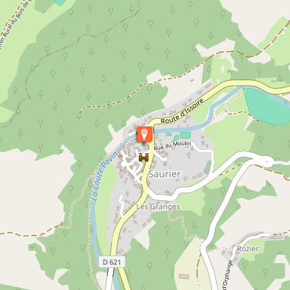
Overhanging 927 m from Saurier and Courgoul, the volcanic peak of Brionnet offers hikers a panoramic view of the couzes and massifs with an orientation table and an access to a romanesque chapel built on basalt organs. Starting point - From the starting sign located in front of the Town Hall, go up the main street to the Place de la Porte Neuve (gate of the old fortified town). Turn left on the D146 towards Brionnet. At the exit of Saurier, in the bend, go up the path to the right until the road. 1 - Cross it and continue on the road opposite until you reach the hamlet of Rozier. 2 - Turn left, cross the hamlet (view of the Couze Pavin valley, the village of Creste and its ruined castle). After 800 m, take the first road on the right until you reach a paved road that leads to the road. 3 - Go up this road, then in the village of Brionnet take the first asphalt road on the right. At the top of the hamlet turn right into the sunken path and go to the road. Cross this road and take the courier that joins this same road. Continue to climb up to the pass. 4 - Turn right and follow the path then the trail to the top of the Pic du Brionnet (Notre-Dame du Mont Carmel chapel built on basalt columns, 360° panorama orientation table). 5 - Return to the pass (point 4), go down the hollow path to the right. Walk past the Lagouzoux farm (view of the Sancy massif). Continue up to the road (hairpin bend). 6 - Go down this one for 80 m. Take the first track on the left below and then turn left again 80 m further on. Join the road and go down the path on the left to continue the itinerary of the outward journey in the opposite direction until the starting point.

3 h
9.4 km
Easy
Parking à gauche après le pont sur la Couze. 63320 Saurier
Show
The tour of the peak of Cluzel
10 km

The tour of the peak of Cluzel

The tour of the peak of Cluzel takes place on a small path that rises gently, following the slopes of the oak wooded peak. Throughout this hike, the views of the valley are many and varied. Starting point - Go up the alley on the right of the church. At the first crossing, turn left and then immediately right. At the water trough, turn right and go up the path opposite. Continue the ascent on the main road to an intersection. 1 - Go down the path on the right. At the T-junction, continue the descent on the right until you reach the village of Pradelle. On the road, turn right until you reach a junction of a road on the left at the exit of the village (transformer post). 2 - Go up this path and continue until you reach a T-junction. Go down to the right (other PR on the left). At the fork, stay on the left. Continue (in the S-curve overlooking the Jonas caves and the Massif du Sancy) until you reach a stone bridge. 3 - Cross it and go down to the right. Go along the stream (ferruginous water source). At the road, turn right, cross the bridge over the Couze Pavin and immediately turn left. Go up into the woods and stay on the main path until you reach a fork. 4 - Go down to the left (old coal ovens and at the headland overlooking the peak of Brionnet, the Notre-Dame du Mont-Carmel chapel and the Gourgoul gorges). Continue on the path (pailhats). At the road, turn right to reach the starting point.

3 h
8.6 km
Medium
Parking près de l'église, monter la ruelle sur la droite de l'église 63320 Courgoul
Show
The Ravine of Quinsat
10 km

The Ravine of Quinsat

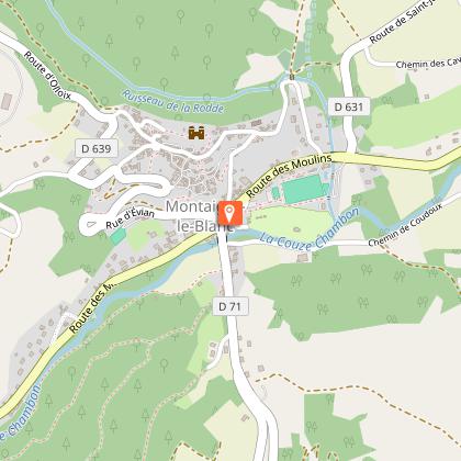
A nice tour via the Quinsat stream (footbridges) that leads to the Ravine of Quinsat and then to the Tour de Rognon, remains of the lords of Montaigut. At the top, the landscape opens up with views of Montaigut-Le-Blanc and the Livradois-Forez mountains. Starting point - At the bridge of Rognon, take the D640 towards Grandeyrolles for 30 m, and go down the road to stream of Quinsat. At the small stone bridge stay on the right bank, and continue upstream across four footbridges. After the fourth footbridge, turn right, cross the brook of Combres, and follow the path that rises in bends to the plateau. 1 - At the crossing on the plateau, take the rightmost path, which goes down slightly at first, before going up to a large path on the left (view on the Forez mountains, the Couzes country and the Sancy massif). Continue until the crossroads in Thone-le-Vieux. 2 - Cross the bridge on the left, then turn right towards Thone-le-Jeune. At the fork, stay to the right and cross Thone-le-Jeune by going down on the left. At the exit, turn right (view of the Sancy river), and continue until you reach Grandeyrolles. 3 - Go through the village (Romanesque church). Continue straight ahead, leaving the puy de Grandeyrolles on the left (view of Livradois-Forez), and then take the winding path down the path that passes under the Rognon tower and reaches the starting point.

3 h
7.4 km
Easy
Stationnement après le pont de Rognon à Montaigut-le-Blanc 63320 Grandeyrolles
Show
The Puy of Gourdon
13 km

The Puy of Gourdon

We are following the footsteps of the templars who took refuge at the Olloix commandery at the time when Auvergne was one of the main territories of the Order of Hospitallers of Saint John of Jerusalem. Superb views, crosses, bridges, megaliths.... Starting point - From the starting sign, go down towards the village of Chaynat. At the first fork, continue to the right. On the village square, turn right towards the rue du Four à pain until you reach the fountain. 1 - Turn left onto Chemin de Gourdon and continue up about 500 m to an intersection. 2 - Take the right track. At the T-junction, turn left. At a new T-junction on the flat, turn right and continue for 50 m (menhir des Deux territoires), until you reach a fork. 3 - Turn right. At the next road, turn left for 300 m, turn left again and continue until a crossing 300 m further on. 4 - Go up to the right on the wide grassy path for a round trip to the top of the Puy de Gourdon (from the top, distant circular view). Back to point 4, continue the path to the right. On the descent, the oblique path to the left before reaching a T-junction, near an agricultural building. Turn left and follow this main road back to point 3, continue to the right and keep east-west for 500 m. The path then turns largely to the left. Continue straight ahead, reach point 2 and continue until you reach the fountain in Chaynat. Follow the road on the right (D74, route de Ludesse) to pass below the church (church and commandery, 15th century). Stay on the road towards Saint-Saturnin. At the end of the village, turn left into rue des Avats, which runs alongside the castle park before going straight up to the starting point of the circuit.

3 h
10 km
Easy
Parking cimetière de Chaynat - Au bord de la départementale 500 m avant le village 63320 Ludesse
Show
La Chaubasse
13 km

La Chaubasse

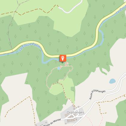
This plateau of summer pastures offers panoramic views of the points of the Massif Central. Its natural spaces conceal many treasures: peat bogs, lakes and waterfalls.... Starting point - From the Place du Marronnier, cross the Couze on the old bridge, (16th century Pède bridge, oratory housing a polychrome wooden virgin with a child), follow the D627 towards the church of Chastel, until the sign indicating the exit of Saint-Floret. Turn left at the cross. Go up to the road, follow it on the right, and then turn right again for 50 m. 1 - Turn left onto a wide track. At the fork, go up on the left, in the middle of the orchards. Take the road on the right, then the first track on the left. Follow it straight on, until you reach a new fork at the entrance to the village of Orphange. 2 - Leave the three drinking troughs on the left, cross the village. At the exit, continue straight on the road (view on Sancy and the peak of Brionnet). In the village of Le Montel, turn left. After the last houses, climb between hedges to a wide path. Take it to the right for 50 m (viewpoint), then turn left on the first path up to the Chaubasse plateau (at the top, very wide panorama). Always go down the same path (leave the transversal paths) to the hamlet of Chazeras. 3 - Turn left, pass in front of the water trough and the washhouse. Continue straight ahead on the hillside. At the fork, follow the right track, until you reach a T-junction. 4 - Go down to the right (view of the Couze valley and its various villages, as far as Issoire), pass under the high voltage line and take the first path on the left until you reach the road you cross. 5 - Possible return to the Chastel site (chapel, ossuary, necropolis). Go down to Saint-Floret by the grassy path, to the right of the hill (Way of the Cross and halfway down the hill, stone cross engraved with a heart, view over the village and the castle). At the road, turn right, cross the Couze on the footbridge, and follow the road on the left to reach the starting point.

3 h
9.6 km
Easy
Traverser la Couze sur le vieux pont - Place du Marronnier 63320 Saint-Floret
Show
Clémensat
13 km

Clémensat

From the medieval village of Saint-Floret, you can cross the Pède bridge to discover orchards, meadows and old terraced vineyards. Beautiful views over the village and the gorges of the couze Pavin. Starting point - From the sign in Saint-Floret, on the Hôtel des Voyageurs car park, place du Marronnier, crossroads between the D26 and the D627, follow the Couze upstream, along the D26, towards Saurier for 200 m. 1 - Just before the speed bump, take the Chemin de la Rochette on the right, which climbs through the gardens to the top of the hill. 2 - 20 m after the power line, take the wide track on the left and go down in front of the houses. At the first crossing, turn left and follow the EDF line (during the ascent, point of view on the village and the church of Chastel). Ignore the first crossing by staying on the left then, when you reach the crow's feet, continue on the right the path that goes up on the plateau. Cross the car park under the power line and take the road in front of it. 3 - Take the road on the right towards the village of Clémensat. Cross the village to the fountain and continue on the road to Saint-Floret. At the end of the village, opposite the campsite, turn left for 20 m and then right (on the climb, view on the terraces: pailhats) and continue until you reach a path on the right (view on the church of Chastel located on the other side of the valley). 4 - Leave the path to follow this path which goes down perpendicularly to the right, then 300 m further on take a left on 400 m. Turn right on the small steep path that goes down in front of the village. At the cross, take the road on the right and cross the village to return to the starting point.

2 h
6.1 km
Very easy
Parking - Hôtel des voyageurs - Place du Marronnier 63320 Saint-Floret
Show

What to do in Murol

See more suggestions
Explore the bookable activity options in Murol for all tastes and ages.
See more suggestions
Auvergne Wildlife Park
24 km

Auvergne Wildlife Park

The Parc Animalier d'Auvergne is a unique reserve for rare and endangered species, with a European reputation. Over a 45-hectare area, you can learn about biodiversity and discover almost 350 rare and endangered animals of 60 different species. Come and meet snow panthers, red pandas, wolverines, tigers, Amur panthers, takins, Tibetan black bears, Rothschild's giraffes, Hartmann's zebras, primates, two-toed sloths, dholes, pygmy hippos, cheetahs and, more generally, 350 rare and endangered animals! The Park is set in an exceptional natural site, where you can admire many incredible views over the Cézallier and discover the various actions put in place for animal welfare and species conservation, while visiting a site that is proving its difference on a European scale. Indeed, the Parc Animalier d'Auvergne stands out in many respects: Europe's largest enclosure for Amur panthers and, new for 2024, the first park to house Thorold deer, the integration of an animal nutritionist and an educational manager into the team, the creation of an association dedicated to ethology and another to learning about biodiversity through new technologies, the offer of novel mixed-use enclosures and a wide variety of immersive activities to familiarize visitors with the animals (family safaris, special encounters, vacation courses, etc.)...). A must-see! Enjoy spectacular enclosures where you can walk right up close to the animals: chamois/bouquetins, lemurs or sika deer, and numerous walkways allowing you to get up close to the animals (red pandas, bears, wolves, giraffes). The Parc Animalier d'Auvergne is deeply involved in the conservation of endangered species around the world, including in Auvergne, notably through the Play for Nature endowment fund, and participates in numerous international breeding programs for endangered species. Located in Ardes-sur-Couze in the Puy-de-Dôme region, the park is just 45 minutes from Clermont-Ferrand and Besse/St Nectaire/Murol, and 15 minutes from exits 15 and 17 of the A75, near Issoire. For the 4th year running, it has been awarded the TripAdvisor certificate of excellence. It has also been awarded the Qualité Tourisme label, and is starred in both the Michelin Auvergne guide and Le Petit Futé. A company with a mission, it received two trophies for its concrete commitment to the environment in 2023, and joined the "Entreprise engagée pour la nature" program.

route d'Anzat-le-Luguet 63420 Ardes
Book from 0 €Book
Show

What to visit in Murol

See more suggestions
Admire the unique architecture of Murol.
See more suggestions
Where to eat in Murol

See more suggestions
The restaurants of Murol await you.
See more suggestions

Where to sleep in Murol

See more suggestions
Stay near Murol with our lodging options.
See more suggestions
Caution!
We have no information on the difficulty of this circuit. You may encounter some surprises along the way. Before you go, please feel free to inquire more and take all necessary precautions. Have a good trip! 🌳🥾