Tours
Activities
Places of interest
Where to eat
Where to sleep

Explore Laborel, Drôme, Rhône-Alpes

Are you in charge of the destination?
Nestled in the heart of the Rhône-Alpes region, Laborel, Drôme is a tranquil haven where visitors can discover a wealth of local activities and attractions. Exploring the hiking trails that wind around Laborel, you will be awed by the natural beauty of the Drôme landscapes, ranging from lush forests to rolling hills. Don't miss the Mont Ventoux, visible from some high points, offering a spectacula...See more

Walking around Laborel

See more suggestions
Stroll through the walking routes of Laborel.
See more suggestions
A l'assaut de la Drôme à vélo
76 m

A l'assaut de la Drôme à vélo

Entièrement dans la Drôme, cette boucle de 82 km fait pédaler au coeur du parc naturel régional des Baronnies Provençales. En chemin, plusieurs cols emblématiques du secteur se succédent (comme le col de Perty et le col Saint Jean). L'itinéraire fait passer également le long de rivières caractéritiques comme le Toulourenc, la Méouge et l'Ouvèze. Depuis Laborel, c'est par une ascension jusqu'au Col Saint Jean que débute cet itinéraire (denivelé positif de 328 m). Redescendre à Izon-la-Bruisse et Eygalayes où les virages s'enchaînent. Regagner la D542 pour rouler jusqu'à Séderon. Il est temps de garvir le Col de Macuègne avec une pente moyenne de 4.7% (dénivelé positif de 262 m). Il offre une vue magnifique sur la face nord du Mont Ventoux. Rejoindre Montbrun-les-Bains, station thermale réputée et village médiéval qui figure parmi les plus beaux villages de France. Suivre la D159 qui longe le Toulourenc (rivière qu'alimente le mont Ventoux et qui coule dans une gorge profonde pour une belle halte rafraîchissante). Après Aulan et le col d'Aulan, rejoindre la D546 pour pédaler jusqu'à St-Auban-sur-l'Ouvèze. De là débute l'ascension pour le fameux Col de Perty (une montée de 18 km de long, pour un dénivelé positif de 698 m). Il faut poursuivre sur la D65, le long de l'Ouvèze (affluent du Rhône) et rejoindre le col par plusieurs épingles qui se succèdent. Le parcours se termine en beauté par une belle descente du col jusqu'à Laborel.

5 h
82 km
Easy
Show
Crêtes de Chamouse
2.8 km

Crêtes de Chamouse

Cet itinéraire à la frontière des départements de la Drôme et des Hautes-Alpes offre une vue panoramique en crête ! L’étendue des espaces en alpages est à couper le souffle. A ne pas manquer ! Au poteau directionnel, emprunter la piste qui descend à gauche. A l’intersection au niveau de la ruine, tourner à droite puis passer devant le poteau « DFCI – réserve de la Tussie ». A la prochaine bifurcation, prendre à droite, remonter la piste en lacets et traverser un petit ruisseau. Poursuivre la montée sur piste jusqu'à une prairie. En continuant tout droit, rejoindre un petit sentier qui longe une clôture. Suivre ce sentier et, plus loin, à l'intersection, prendre tout droit ; possibilité de monter directement sur la crête par la droite. Traverser un petit ruisseau à sec puis un espace marneux. Grimper alors au Col de Tous les Vents précédé d’un petit passage en forêt. Au col, poursuivre la sente à droite puis traverser une Forêt Domaniale en empruntant une large piste à droite. A la prochaine intersection, prendre à droite en montant pour atteindre le col d’Izon (1343 m). Au col d'Izon, tourner à droite, direction "Montagne de Chamouse - 1,5 km". Suivre les balises qui mènent aux vastes alpages de Chamouse. Traverser les alpages jusqu’au sommet de Chamouse (1532 m). Il n’y a plus de sentier sur cette partie du parcours, suivre les cairns. Redescendre sur 900 m le long de la crête. Au poteau directionnel, bifurquer à droite sur un petit sentier descendant dans la forêt ("La Tussie" - 1430 m) direction "Laborel". Traverser la hêtraie, et continuer à descendre. Plus bas, le sentier devient une piste. Poursuivre sur cette piste pour revenir au point de départ.

5 h
11 km
Easy
Show
Hiking trail "les Crêtes de Chamouse"
3 km

Hiking trail "les Crêtes de Chamouse"

This route on the border of the Drôme and Hautes-Alpes departments offers a panoramic and gorgeous viewpoint on a ridge ! The large mountain pasture areas are breathtaking. A must-see ! 1 - Start - path At the post 182 " col de Chamouse ", take the path going down on the left. 2 - Crossroad - post FFRP 123 At the level as the ruins (post 123), turn right then go by the sign " DFCI - réserve de la Tussie ". 3 - Crossroad - fork (new path - no signs on this part) Go left, then up the path and across a small stream. At the ledge, you can see multiple lavender fields on your left. 4 - Old route crossroad Proceed forward until you reach a small trail with yellow signs. At the crossroad - post FFRP 120 - Izon Go toward Izon, you can also go up directly to the ridge on the right. Follow the path with the fence on the left. You can see the Chamouse above you on the right. Cross a small dried up stream and then a marl area. Climb up to the mountain pass "tous les vents" after crossing a small forest path. 5 - Tous les Vents pass - viewpoint As the name suggests, this mountain pass is very windy ! Follow the path on the right above a small canal and go across the domain's forest on a large path. 6 - Crossroad - toward Izon's pass - viewpoint of Mount Ventoux Turn right up to the Izon mountain pass. This path gives you a clear view of the Mount Venoux (1912 m) on the left. Mount Ventoux → 7 - Crossroad - Izon's Pass (1343 m) Turn left toward " Montagne de Chamouse - 1,5 km ". Follow the large stones and proceed on the path with the yellow signs, to arrive on wide mountain pastures. Take the time to enjoy this unique moment and the surrounding view ! Cross the pastures by following the yellow signs, the cairns and the shepherd pathway. Chamouse's Pastures → 8 - Chamouse's peak (1532 m) Take in the amazing view ! Be careful on the sides of the ridge. 9 - Ridge - crossroad with "la Tussie" post Go down after 900 m on the left side of the ridge then turn right at a small descending forest trail (post : "la Tussie – alt. 1430 m - Direction Laborel") 10 - Beech forest - crossroad at the sign " Sous la Tussie " Cross the forest, at the sign " Sous la Tussie - alt. 1343 m ", continue going down on the left. Return trip - trail Continue following the same trail until reaching a path taking you back to the starting point (ignore the left and right turns).

5 h
12 km
Medium
Piste de la Tussie - Route du Col de Perty 26560 Laborel
Show
Hiking trail "Les trois cols"
3.7 km

Hiking trail "Les trois cols"

Starting from the village of Etoile, this trek lets you cross 3 mountain passes : l'Etoile, the Collet de Martin and Adrechon while discovering varied landscapes (marls, woodlands, old village...). 1 - Start – viewpoint of the Adrechon mountain pass From the village church, cross the village and after the first left turn, go right toward the pass of Adrechorn – Laborel. Follow the yellow signs. The path continues on a road facing the Adrechon's Pass in the distance. 2 - Crossroad – toward the mountain pass of Etoile Follow the path going up then turn right and take the path inside the forest (toward the pass of Etoile). Cross the forest and go up the marls to reach Etoile's mountain pass. 3 - Viewpoint – Etoile's Pass – Crossroad Panoramic view of the Céans valley toward Etoile and the village of Villebois les Pins as well as the Pierre-Vesce mountain. Take the left road and follow the path going through the trees. 4 - Collet de Martin At a hard to see crossroad, take the left path going up with the yellow signs. At the Collet de Martin, follow the road to the left toward " le plan ". Go down the pass toward les Blaches on the road bordering a small stream. 5 - Crossroad At the post with the sign 115 – Charoule, take a left to reach the mountain pass of Adrechon. Follow the road going up in this direction. 6 - Viewpoint – Adrechon's Pass Enjoy the view of the village of Etoile and of the marls. Return Trip Follow the same path to reach the village.

2 h
6 km
Easy
Eglise du village 05700 Étoile-Saint-Cyrice
Show
Hiking trail "les versants du Céans"
4.1 km

Hiking trail "les versants du Céans"

This trek crosses a vegetation unique to provence, and should be done slowly to fully appreciate it, and know more about Céans river. A few small hamlets are on the way where you can take a dip. 1 - Start - village Park in front of the city, go back to the main road, then turn left at the bus stop (in front of the Logis de France), take the asphalt road that goes up on the right (toward Januard 30 minutes). 2 - Crossroad - path A few meters later, go off the road and follow a path on the right (follow the path on the ground). Proceed on this path, and turn left at the fork. 3 - Crossroad - mountain path - small steep path Proceed forward (ignore the right path) and follow the trail on the side of the Céans river, prepare yourself for a steep way up right ahead ! Underwood trail - up and down paths At the hamlet of Le Plan, carefully follow the signs. Proceed the steep ascent, and turn right after a few meters, then left going down. After a mountain trail, follow the path leading into a small clearing. Clearing - crossroad Go lightly down on the right until a cairn, then follow a trail through the trees (the path isn't very visible) Crossroad - trail Turn left then go up on another path, then down on a long rocky trail until you reach a small cliff with a torrent. Crossroad - meadow Turn right then go down the meadow then follow along on the right. 4 - Crossroad path - hamlet Cross the torrent of Les Blaches then turn left at the crossroad with a forest trail. 5 - Hamlet of Le Plan - road At the hamlet, go down on the left until road D65, cross it on the left and take a right a few meters later (sign "vente directe de produits"). Cross the bridge over the Céans river then proceed on the left. 6 - Hamlet of Les Combes - path - ruins Go across the hamlet of Les Combes, then pass a small stream and go up the path until you reach ruins. Walk along them on the right, then along the field on the left to reach a path going up on the right (just after a small ravine, with a poplar tree). 7 - Path - crossroads Follow the path going up until a fork, then turn left twice following the ridge path. Cross a sheep pen, go over a fence and go back down a trail on the left toward road D65 following the yellow signs. 8 - Crossroad - road (post 185) Turn left to cross the Céans river in the other direction and reach the road, then follow it on the right for 500 m. 9 - Crossroad - bridge - trail Go right, cross the bridge then follow a path on the left just after (the sign is a bit hard to see !) proceed until crossing a small stream, then walk along on the right. 10 - Crossroad fork At the fork, go left at the cairn on a trail going up. 50 m later, go left on the trail along the Céans river, where you'll have a viewpoint of the Les Combes hamlet. 11 - Trail on the side of the Céans Walk along the Céans on the left, and take this opportunity to take a break and a dip if the weather is hot... Proceed by crossing the fields and walking along the Céans on the left.

4 h
11 km
Easy
Les Bégües 05700 Sainte-Colombe
Show

What to do in Laborel

See more suggestions
Experience unique moments with the bookable activities in Laborel.
See more suggestions

IGN cards

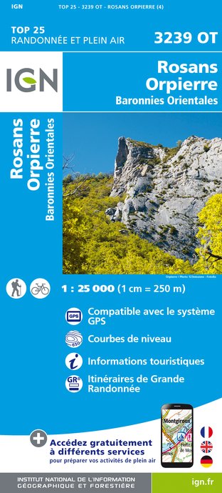
3239OT - ROSANS ORPIERRE BARONNIES ORIENTALES
Editor : IGN
Collection : TOP 25 ET SÉRIE BLEUE
Scale : 1:25 000
13.90€
VEL01 - LA DRÔME A VELO
Editor : IGN
Collection : DECOUVERTE A VELO
Scale : 1:105 000
9.10€
VEL03 - LE VAUCLUSE A VÉLO
Editor : IGN
Collection : DECOUVERTE A VELO
Scale : 1:100 000
9.10€
TOP100D26 - DRÔME VALENCE MONTÉLIMAR DIE PNR DES BARONNIES PROVENÇALES PNR DU VERCORS
Editor : IGN
Collection : TOP 100
Scale : 1:100 000
8.40€

TOP100D04 - ALPES-DE-HAUTE-PROVENCE DIGNE MANOSQUE PNR DU VERDON LAC DE SERRE-PONÇON
Editor : IGN
Collection : TOP 100
Scale : 1:100 000
8.40€
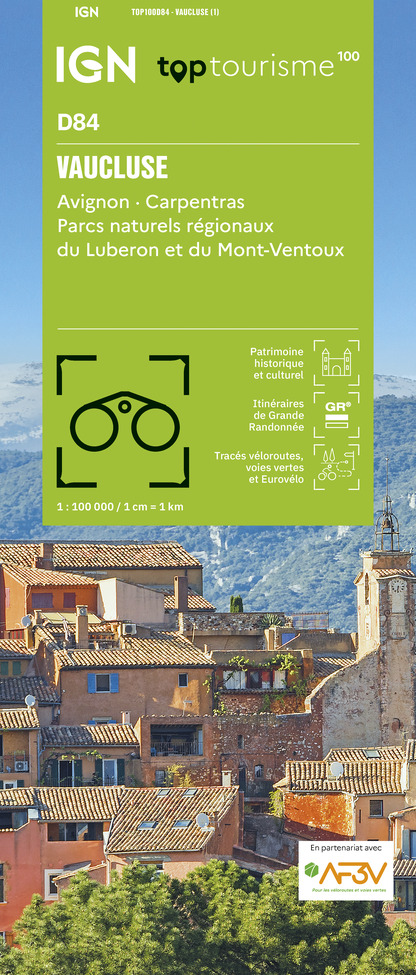
TOP100D84 - VAUCLUSE AVIGNON CARPENTRAS PARCS NATURELS RÉGIONAUX DU LUBERON ET DU MONT-VENTOUX
Editor : IGN
Collection : TOP 100
Scale : 1:100 000
8.40€
D07-26 ARDÈCHE DRÔME
Editor : IGN
Collection : CARTES DÉPARTEMENTALES IGN
Scale : 1:150 000
5.90€
D04-05 ALPES-DE-HAUTE-PROVENCE HAUTES-ALPES
Editor : IGN
Collection : CARTES DÉPARTEMENTALES IGN
Scale : 1:150 000
5.90€
D13-84 BOUCHES-DU-RHÔNE VAUCLUSE
Editor : IGN
Collection : CARTES DÉPARTEMENTALES IGN
Scale : 1:150 000
5.90€
NR14 AUVERGNE-RHÔNE-ALPES RECTO/VERSO MASSIF CENTRAL
Editor : IGN
Collection : CARTES RÉGIONALES IGN
Scale : 1:250 000
6.80€
NR16 PROVENCE-ALPES-CÔTE D'AZUR
Editor : IGN
Collection : CARTES RÉGIONALES IGN
Scale : 1:250 000
6.80€
NR15 AUVERGNE-RHÔNE-ALPES RECTO/VERSO MASSIF ALPIN
Editor : IGN
Collection : CARTES RÉGIONALES IGN
Scale : 1:250 000
6.80€
EUROPE
Editor : IGN
Collection : DÉCOUVERTE DES PAYS DU MONDE IGN
Scale : 1:2 500 000
7.00€

What to visit in Laborel

See more suggestions
Admire the unique architecture of Laborel.
See more suggestions

Where to eat in Laborel

See more suggestions
Discover the culinary diversity of Laborel.
See more suggestions

Where to sleep in Laborel

See more suggestions
Stay near Laborel with our lodging options.
See more suggestions
Caution!
We have no information on the difficulty of this circuit. You may encounter some surprises along the way. Before you go, please feel free to inquire more and take all necessary precautions. Have a good trip! 🌳🥾