Tours
Activities
Places of interest
Where to eat
Where to sleep

Explore La pesse, Jura, Franche-Comté and its wonders

Are you in charge of the destination?
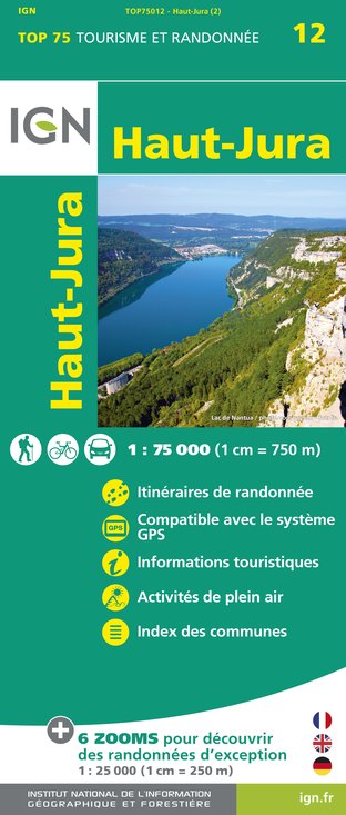
Nestled in the heart of the Jura mountains, La Pesse is an invitation to escape, a haven for nature lovers and explorers of cultural treasures alike. In summer, hikers will find the ideal playground with marked trails offering spectacular panoramic views. The Haut-Jura Regional Natural Park provides varied landscapes, from forests to flower-filled meadows, perfect for walking or cycling adventures...See more

Walking around La pesse

See more suggestions
Explore the walking circuits of La pesse.
See more suggestions
Around the Rocks of Orvaz
120 m

Around the Rocks of Orvaz

Forests, clearings and prairies, full of life, culminating at the jagged cliffs of the Rocks of Orvaz for a well-deserved break with a clear view over the valley of the Semine and the Orvaz cirque. From LA PESSE,, head to the La Pesse church. Turn left (MTB waymark no. 39) up route de Chaudezembre, and then descend to the Chaudezembre hamlet. Continue left on a tarmac road surrounded by pastures, ascending up to The quarry.Continue towards the Old Dairy for another 400 meters along this road, and then turn left at Cernois Bouiller, following a grassy path through a pasture. From here, cut through a long forest on a succession of grassy, rocky and muddy paths, including a short section of forest path. As it is relatively flat, this part of the trail can become humid and requires that you be careful. At the D25, head down the grassy, and later stony, trail on your left, joining up with the D25 400 meters further on at a hangar. Continue right on the D25 until you reach the Old Dairy. Branch off to the left (with care), and ascend a small road until you reach the ROCKS OF ORVAZ viewpoint. Continue on this road until you come to an adapted viewpoint (get off your bike). On returning to the road, continue towards le Montelet. Branch off to the left on a forest path, then take a muddy and stony path that opens onto the Cernétrou woods. Reach the Pass in Sur la Semine via a little grassy path to the left through the middle of pastures, and equipped with MTB paths, before joining up with the D25 once more. Take this road to return to the La Pesse church.

3 h
14 km
Very easy
Show
The Crossing of Corridors
2.5 km

The Crossing of Corridors

From Les Bouchoux to the Moulin waterfall, passing through the Crossing of Corridors, this walk invites you on a journey of the senses through the high valley of Tacon, where there is only sound, landscape and light. From LES BOUCHOUX, the hike starting point, at the foot of the village near the bar and the grocery, the trail (yellow and red waymarking) ascends the small road to the right, parallel to the D 25 E1, until it reaches Bonneville.  The “chemin des Couloirs” ascends to the right and heads past a reservoir. After a stable; climb up a narrow trail to reach the forest. The path opens on to a rocky ridge (be caureful!). Follow the ridge line until you reach THE CROSSING OF CORRIDORS. Via the ridge, reach the Guichard Corridor (former ski humping hill). Head north (yellow waymarking) and reach the D 25 at la Crochère through pastures and wooded meadows. Follow the road to the left, and come to Sur l’Enversy via a grassy trail. The trail heads along a barrier and joins up with a stone path (quarry below the la Crochère cliffs). After a bend, reach the road at l’Enversy. The road descends to the right until it comes to the intersection at Le Prieuré. Continue on a path to your left and head past the hamlet of Prioré. Descend through a forest trail (tuffaceous concretion). After a short ascent, through a pasture, head between two houses to reach Les Petits-Bouchoux to the right. Head down a road to your right for 150 m. Branch off once more to the right to follow a path along the right embankment of the Tacon. Cross the torrent (bridge), and head up a trail to Moulin d’Aval for 100 m. Descend to the foot of the MOULIN WATERFALL, using the adapted trail. Head back the same way you came. From Les Petits Bouchoux, the road to the left, followed by a road suitable for vehicles, will lead you back up to the village of Les Bouchoux, leaving a Little Combe behind you to your left. Cut across the square and through the village to return to your starting point.

3 h
7.9 km
Very easy
Show
The Rocks of Orvaz
6.2 km

The Rocks of Orvaz

This beautiful hike through open landscapes will lead you to the edge and then to the heart of a formidable natural amphitheatre, the Orvaz combe, carved by the Semine river. From the BELLEYDOUX CHALET, the trail descends via a road to the left (yellow waymarking) towards the church Head around the church and along a first cemetery before walking under a second. Head down a farm path and cross over the Chon (stream) before heading up a meadow. Find a little road that leads to the entrance to the hamlet of GOBET. The road ascends to the right (drinking trough, vaulted cistern) into the hamlet and then branches off to the left (ignoring the road to the right towards Châtelet). You will come to a hairpin in the road. Continue on a farm path (hedges) until you reach a stony path. Continue to the left and head up into the forest until you reach la Croix. The road continues to the left and comes to a cistern at le Bugnon. Branch off to the right (earthy path) to reach the CHEMIN DU FACTEUR. > You can access the ROCKS OF ORVAZ by following the trail to the left, within 30 minutes there and back. On returning to the CHEMIN DU FACTEUR, descend through the meadows toward Orvaz to the south. On the verge of a pretty beech forest, turn left (the descent is steep, be careful!) to reach “chemin du Soufflet”. From here, branch off to the left (crossing the stream) and exit through the meadows into the hamlet of ORVAZ. > The Semine riverside is 30 minutes away there and back on your left (not waymarked). Follow the road to the right for 600 m until you come to a wooded square at the Pontard Bridge. Cross the bridge and ascend for a few tens of meters, then branch off to the right to follow a trail along the left embankment of the Semine until you come to the viaduct (viewpoint to the north over the tope of a gendarme and its limestone folds). Cross the viaduct to your right.   Take the road below the D 48 to your left. Head past two houses. The path slowly ascends to Bas Belleydoux. Follow the road to your left and head past a bend. Take a trail to your right that cuts across a bend in the road. Follow the road to the right, and head opposite a crossing, towards the village, that you will reach by ascending through meadows.

3 h
11 km
Show
The balconies of the Valserine
7 km

The balconies of the Valserine

From the bottom of its valley overlooked by the ridges of the Jura, the Valserine, the first French river to be awarded the “wild river” label, guides hikers and brings this circuit to life, starting in Chézery-Forens, home to an old abbey. From the Hike Information Relay to your left when heading down the village, ascend a small road to the left (yellow waymarking). Head past the last houses. The path ascends into the valley of Vacheran (stream), and opens onto the Bellaigue plateau. Follow the stony path to your left, it will become grassy and later paved, until you reach la Grande Bossona (traditional houses and views over the ridges framing the valley). Head up a small road to the right, then continue left (stony path) until you come to ROSSET and its round fountain. Head 40 m down the road to the left, then take a path to your left and turn right onto a trail. Exit onto a road, and follow the road to the right for 100 m. Take the trail to your left and arrive at the D 991 (cross with care). Head down the path to your left until you reach Platelets. The trail ascends to the right and joins up with a ridge overlooking the Valserine (belvedere; mountain pine planted at the end of the 19th century to avoid landslides). Continue left on the trail (sculptures) to enter the hamlet of LA RIVIERE on the edge of the D 991. The path descends to the left and then heads immediately right and crosses over the Troubléry (torrent). Follow the road until you come to the procession of THE SWALLOWS’ ROCK, on the edge of the Valserine. Continue along the embankment until you reach DEVIL’S BRIDGE. Cross the bridge and branch off to the left (narrow and steep trail overlooking the tumultuous waters of the Valserine, be careful!). Continue on this steep trail until you come to an intersection. Take the trail to your left towards the Thomas Mill. After a sharp bend (pay attention to the waymarking), head along the edge and exit near la Miérette. The trail descends to your left (viewpoint over the Swallows’ Rock. Be careful!) and joins up with a stony trail on a balcony over the river. Arrive at the ruins of the Thomas Mill. Cross the bridge and follow the path along the left bank until you come to the hamlet of Fontaine Bénite. > The Fontaine Bénite oratory is accessible within 5 mins there-and-back to your left. Continue your path by taking a trail near the river to your right (turnstile), and return to your starting point.

3 h
13 km
Show

What to do in La pesse

See more suggestions
Book your activities in La pesse and experience memorable moments.
See more suggestions

What to visit in La pesse

See more suggestions
Stroll through the historic districts of La pesse.
See more suggestions

Where to eat in La pesse

See more suggestions
Enjoy delicious dishes at La pesse's restaurants.
See more suggestions

Where to sleep in La pesse

See more suggestions
Stay in unique accommodations in La pesse.
See more suggestions
Caution!
We have no information on the difficulty of this circuit. You may encounter some surprises along the way. Before you go, please feel free to inquire more and take all necessary precautions. Have a good trip! 🌳🥾